Livres
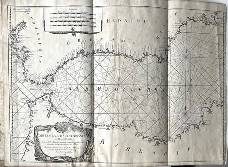
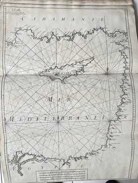
Carte de la mer Méditerranée en douze feuilles. Dédiée à Mr le duc de Choiseul.
-
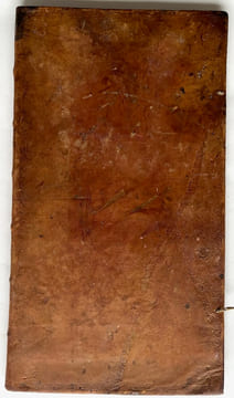
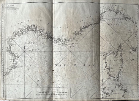
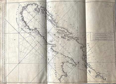
Edition originale de cet atlas dû à Joseph Roux (1725-1789), hydrographe et peintre de marine français. Un exemplaire de cet atlas a été utilisé à bord du navire amiral de Nelson, le HMS Victory, en 1802 et 1803, montrant ainsi que la Royal Navy s'appuyait sur des cartes britanniques et étrangères imprimées à titre privé, même après la création du Bureau hydrographique de l'Amirauté par Alexander Dalrymple en 1795. Les cartes très détaillées de cet atlas font apparaître la profondeur, les ports, les fortifications et les villes de toute la côte méditerranéenne : de Cadix et du détroit de Gibraltar à Oran et Tunis ; de l'Algérie et des Baléares ; du Languedoc à la Corse et à l'île d'Elbe ; de la mer Tyrrhénienne ; de Minorque, de la Sardaigne et de la Tunisie ; de la Sicile, de Malte et de la Libye ; de la mer Adriatique ; de la Libye ; de la Crête, de la Libye et de l'Égypte ; au sud de la Turquie, de Chypre, de la Palestine et de l'Égypte ; au sud des îles Egadi et de la Crète ; et au nord des îles Egadi et des Dardanelles. Bel exemplaire. 1 vol. in-plano (610 x 340 mm) with : 12 folding engraved maps (approx. 605 x 820 mm). (some stains in the margins, wetness in the lower margin of some maps). Contemporary full tan basane, floral motifs and frieze framing the cold-stamped boards, traces of laces, spine ribbed and muted (binding rubbed and scuffed, stain at bottom of first board). First edition of this atlas by Joseph Roux (1725-1789), a French hydrographer and marine painter. A copy of this atlas was used aboard Nelson's flagship, HMS Victory, in 1802 and 1803, showing that the Royal Navy relied on privately printed British and foreign charts, even after the creation of the Admiralty Hydrographic Office by Alexander Dalrymple in 1795. The highly detailed charts in this atlas show the depths, ports, fortifications and towns of the entire Mediterranean coast: of Cadiz and the Straits of Gibraltar to Oran and Tunis; of Algeria and the Balearic Islands; of Languedoc to Corsica and Elba; of the Tyrrhenian Sea; of Menorca, Sardinia and Tunisia; of Sicily, Malta and Libya ; Adriatic Sea; Libya; Crete, Libya and Egypt; southern Turkey, Cyprus, Palestine and Egypt; southern Egadi Islands and Crete; and northern Egadi Islands and Dardanelles. A fine copy.
7 500,00 €
Cet article vous est proposé par :

librairie@jfletenneurlivresrares.fr
06 81 35 73 35
Règlements :
Chèque, Autres
À explorer sur ce thème
Lancer une recherche sur cet auteur ?
Voir les 60 résultats pour « ROUX (Joseph). »Cet article est répertorié dans :
- Roux Joseph