Livres
Référence : 14630A. Bonte
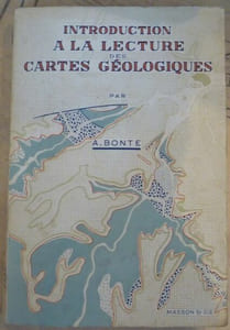
Introduction à la Lecture des Cartes Géologiques1962. Paris Éditions Masson & Cie 1962 3ème ed. 2ème tirage - Broché 17 cm x 25 cm 277 pages 103 figures in-texte et 8 planches hors-texte - Texte de A. Bonte préface de E. Raguin - Très bon état
Rochefort, France
40,00 €
Livres
Référence : RO20273889A. BREHAT - GRAINDORGE (cartographie) - COLLECTIF
Guide azur 56 - postes azur classes par ordre alphabetique des localites ...DESMARAIS FRERES / IMP. VIEILLEMARD. 1956. In-12. Broché. Etat d'usage, Couv. légèrement passée, Agrafes rouillées, Quelques rousseurs. 126 pages - Nombreux plans en noir et blanc, dans et hors texte & 14 cartes couleur sur planches dépliantes - Texte sur deux colonnes - coins frottés - 1er plat avec rabat. . . . Classification Dewey : 53-Guide
Classification Dewey : 53-Guide

Sablons, France
14,90 €
Livres
Référence : 31328A. Cattaneo
Fra Mauro's Mappa mundi and Fifteenth-Century Venice / Terraum orbis 8, brepols, 2011 Hardback. 470 pages ., 3 b/w ill. 16 colour ill., 210 x 270 mm, Languages: English, Terraum orbis 8 ISBN 9782503523781.
Fra Mauro's mappamundi, drawn around 1450 in the monastery of San Michele on Murano in the lagoon of Venice, is among the most relevant compendia of knowledge of the Earth and the Cosmos of the fifteenth century. By examining literary, visual, textual and archival evidences, some long considered lost, this book places the map within the larger context of Venetian culture in the fifteenth century. It provides a detailed analysis of both its main sources (auctores veteres such as Pliny, Solinus, Ptolemy, and novi, like Albert the Great, Thomas Aquinas, Marco Polo and Niccolo de? Conti) as well as of the composite networks of contemporary knowledge (scholasticism, humanism, monastic culture, as well as more technical skills such as marine cartography and mercantile practices), investigating the way they combine in the epistemological unity of the imago mundi. More a work on intellectual history than cartography, the book constructs a complex set of frameworks within which to situate Fra Mauro?s monumental effort. These range from the cultural history of the reception of the world map from the fifteenth to the nineteenth centuries to the analysis of the material conditions under which map-makers such as Fra Mauro worked; from the history of ideas, especially of natural philosophy to the links between world representations and travel literature. It also addresses the Venetian reception of Ptolemy?s Geography, the interactions between Venetian art, theology and cosmography and the complexities of the Venetian vernacular. The books develops a multi-tiered approach, in which different elements of the rich cultural context in which this world map was created, interact with each other, each casting a new light on the encyclopaedic work being analyzed.

Antwerpen, Belgique
99,90 €
Livres
Référence : 45717A. Cattaneo
Fra Mauro's Mappa mundi and Fifteenth-Century Venice, Brepols - Harvey Miller, 2011 Hardcover. 470 p., 3 b/w ill. 16 colour ill., 210 x 270 mm, Languages: English, Including an index. Fine copy. ISBN 9782503523781.
Fra Mauro?s mappamundi, drawn around 1450 in the monastery of San Michele on Murano in the lagoon of Venice, is among the most relevant compendia of knowledge of the Earth and the Cosmos of the fifteenth century. By examining literary, visual, textual and archival evidences, some long considered lost, this book places the map within the larger context of Venetian culture in the fifteenth century. It provides a detailed analysis of both its main sources (auctores veteres such as Pliny, Solinus, Ptolemy, and novi, like Albert the Great, Thomas Aquinas, Marco Polo and Niccolo de? Conti) as well as of the composite networks of contemporary knowledge (scholasticism, humanism, monastic culture, as well as more technical skills such as marine cartography and mercantile practices), investigating the way they combine in the epistemological unity of the imago mundi. More a work on intellectual history than cartography, the book constructs a complex set of frameworks within which to situate Fra Mauro?s monumental effort. These range from the cultural history of the reception of the world map from the fifteenth to the nineteenth centuries to the analysis of the material conditions under which map-makers such as Fra Mauro worked; from the history of ideas, especially of natural philosophy to the links between world representations and travel literature. It also addresses the Venetian reception of Ptolemy?s Geography, the interactions between Venetian art, theology and cosmography and the complexities of the Venetian vernacular. The books develops a multi-tiered approach, in which different elements of the rich cultural context in which this world map was created, interact with each other, each casting a new light on the encyclopaedic work being analyzed. Angelo Cattaneo, who holds a Ph.D. in History from the European University Institute in Florence, is a researcher at the Centro de Historia de Alem-Mar of the Universidade Nova de Lisboa (Center for Overseas History of the New University of Lisbon). Currently he is studying the global circulation of knowledge, technology and material culture from the fifteenth to the seventeenth centuries, particularly cosmography, cartography and travel literature. He is the author of Mappa mundi 1457 (Rome, 2008). He also co-edited the volumes The Making of European Cartography (Florence, 2003) and, with Nathalie Bouloux and Patrick Gautier Dalche, Humanisme et decouvertes geographiques (Medievales 58, 2010).
Antwerpen, Belgique
106,40 €
Livres
Référence : 44982A.D. von den Brincken
Kartographische Quellen: Welt-, Regional- und Seekarten, Brepols - Harvey Miller, 1988 Hardcover. 132 p., 160 x 240 mm, Languages: German, Fine copy. Including an index. ISBN 9782503360515.
Antwerpen, Belgique
30,80 €
Livres
Référence : 45004A. Verhulst
paysage rural: les structures parcellaires de l'Europe du Nord-Ouest, Brepols - Harvey Miller, 1995 Hardcover. 88 p., 24 pl., 160 x 240 mm, Languages: French, Fine copy. Including an index. ISBN 9782503360737.
Le present ouvrage est consacre au paysage rural du Moyen Age, qui constituait le cadre de vie de la plus grande partie de la population jusqu'au derniers siecles de cette periode.
Antwerpen, Belgique
35,73 €
Cartes géographiques
Référence : boz_006230Abbé Jean Delagrive
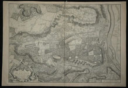
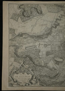
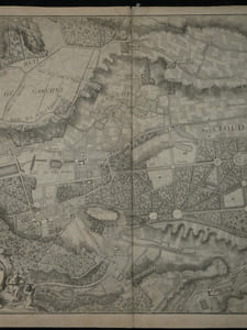
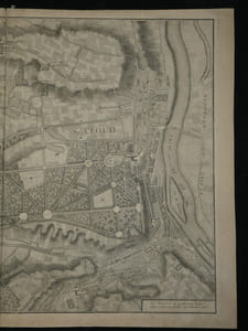
Rare Plan Original de Saint-Cloud - 1744 - Abbé DELAGRIVE - Carte Ancienne XVIIIeRare Plan Original de Saint-Cloud - 1744 - Abbé DELAGRIVE - Carte Ancienne XVIIIe Grand format, limites de Paris, Bois de Boulogne, Garches, Vaucresson. Gravure sur cuivre. Véritable document historique, cette carte finement gravée détaille avec une grande précision le domaine de Saint-Cloud, son château, le dessin de ses jardins et parcs, ainsi que les territoires environnants (Boulogne, Sèvres, Garches, Vaucresson) au milieu du XVIIIe siècle. Elle se distingue par un superbe et imposant cartouche allégorique. Cartographe : Abbé Jean Delagrive (1689-1757), Géographe de la Ville de Paris. Titre exact : « Plan de St. Cloud levé et dedié à S.A.S. Monseigneur LE DUC DE CHARTRE » Date d'édition : 1744 Graveurs : M. Maroye (sculp.) et M. Fourneau (scripsit, pour la lettre). Éditeur / Imprimeur : Imprimerie de Charbonnier, rue St Jacques au Chariot d'Or (Paris). Technique : Gravure originale sur cuivre (eau-forte et burin) tirée sur papier vergé. Dimensions : de la feuille : 92,4 x 63,5 cm ; à la cuve : 86 x 62 cm État : Bon état général, quelques rousseurs et brunissures marginales éparses, de petites déchirures en marge (visibles sur les clichés de détail), sans manque majeur. Ancienne restauration en papier en haut de la pliure centrale au dos. On note également une mention manuscrite ancienne au crayon « St Cloud ». Voir photos et description pour plus de détails.
Fondettes, France
160,00 €
Livres
Référence : 69194Abrahamus Ortelius
Theatrum Orbis Terrarum, Antwerpen 1570 (117/175)Antwerp, Standaard Uitgeverij, 1570/1970 Lederen band, editie van 175, dit is nummer 117. 41 x 28.5 cm. *in mooie staat.
Deze facsimile-uitgave van Abraham Ortelius Theatrum Orbis Terrarum werd op 20 mei 1970 in een beperkte oplage van 175 exemplaren uitgegeven door Standaard Uitgeverij te Antwerpen ter herinnering aan het feit dat de eerste uitgave op 20 mei 1570 te Antwerpen verscheen. Dit is nummer 117.
Antwerpen, Belgique
175,00 €
Revues
Référence : 52909Actes de la Recherche en Sciences Sociales
Actes de la Recherche en Sciences Sociales - Directeur Pierre BourdieuThème : Stratégies de reproductionStratégies matrimoniales et choix d'objet incestueux : Dot, dilôme, liberté sexuelle, prénom ( Bernard Vernier ) - Peut-on classer la famille hindoue ? ( Roland Lardinois ) - Vers une théorie sociologique des mariages interconfessionnels : le cas de la nuptialité en Hongrie sous l'ancien Régime ( Victor Karady ) - L'éffondrement des bases sociales du familialisme ( Remi Lenoir )- " Comment vous-êtes-vous connus ? " Une expérience de codification multiple ( Dominique Merllié ) - La France des familles : usages de Le Play et de la cartographie ( D. Merllié ) - Un patronat paternel ( Michel Pinçon ) - L'éducation morale des ruraux. Tu seras agriculteur. Histoire d'une famille de cultivateurs. Un manuel de lecture de l'école primaire ( Rémy Ponton ) - Chronique Peugeot ( Christain Corouge, Michel Pialoux ) -1985 1 vol in-4 - broché - N° 57/58 de juin 1985 - 134 pages
Bon état de conservation

Lyon, France
10,00 €
Livres
Référence : ORD-14350[AFRIQUE].-
Carte Ecclésiastique de l'Afrique au 1/12000000e par le R. P. Meillorat de la Congrégation du St Esprit et du Sacré Coeur de Marie.-Supplément du Journal des Missions Catholiques. Paris. Imp. Lemercier. 1892. Grande feuille de ca 740 x 900 mm, pliée en 16, carte de ca 690 x 720 mm. Carte de l'Evêché de San Iago dans un tout petit cartouche (120 x 50 mm). A gauche de la carte, tableau des Archevêchés, Evêchés, Vicariats et Préfectures Apostoliques, au dessus de ce tableau Etat du Catholicisme en Afrique d'après l'ouvrage Orbis Terrarum Catholicus de R.P. Werner S. J. Réparations au dos aux croisements des pliures mais bon exemplaire, tiré en noir et souligné de rouge et d'orangé.
Toulon, France
90,00 €
Livres
Référence : ORD-59[AFRIQUE].-
Nouvelle carte de l'Afrique.-Echelle 1/8 000 000°, format 110 x 120cm. Tirage en 6 couleurs. Taride. s.d. Grande carte dressée par PELTIER, plusieurs fois repliée (mal) dans sa couverture d'origine (salie et un peu déchirée). Petites déchirures aux coins de pliage sans manques.
Toulon, France
61,00 €
Livres
Référence : ORD-73[AGEN].
Carte d'Etat Majorau 1/80000 levée par les Officiers du Corps d'Etat-Major et publiée par le Dépôt de la Guerre en 1859. Imp.Lemercier. Gde carte en 4 pièces collées sur toile (580x845mm)
Toulon, France
46,00 €
Cartes géographiques
Référence : 79232AIR FRANCE
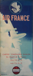
Cartes itinéraires Dunlop au départ de la France vers l'A.E.F. et vers l'A.O.F.- Broché. 28 pages. 11 x 25 cm.
Carte géographique. Air France - Edicta, Vers 1950.

31,50 €
Livres
Référence : GF29767Albert COCHON de LAPPARENT - [Bourges 1839 - 1908] - Géologue français
Lettre signée à Monsieur le Président - Paris le 10 janvier 1896 -1 page in4 - En tête de la Société de Géographie -
A propos de l'envoi d'une carte de l'Afrique rectifiant les frontières des cartes d'origine allemande ou anglaise "parfois en opposition avec nos intérêts nationaux" - [La lettre est également signée par Charles Maunoir - secrétaire général de la Société de Géographie ] - On joint une notice nécrologique imprimé (avec portrait) de F. Schra der -
Nyons, France
50,00 €
Livres
Référence : 35617Albert KAMMERER
La Mer Rouge, l'Abyssinie, et l'Arabie depuis l'Antiquité - Essai d'Histoire et de géographie historique -1929 Le Caire - Société Royale de Géographie d'Egypte - 1929 - 1952 - Complet en 7 volumes in-folio - 463 planches dont 38 en couleurs - Les trois premiers en reliure moderne, les 4 autres en cartonnage éditeur - Monumental ouvrage très rare complet car paru sur plus de 20 ans -
Tome 1: "Les Pays de la Mer Erythrée jusqu'à la fin du Moyen Age" (2 vol.) - Tome 2: "Les Guerres du Poivre - Les Portugais dans l'Océan Indien et la Mer Rouge au XVIéme siècle - Histoire de la Cartographie orientale" (2 vol.) - Tome 3, première partie: "XVIéme siècle - Abyssins et Portugais devant l'Islam" - Tome 3, seconde partie: "Les Jésuites portugais et l'éphémére triomphe du catholicisme en Abyssinie (1603 - 1632)" - Tome 3, troisième partie: "La Cartographie du monde oriental, mer Rouge, Océan Indien,et Extrème Orient jusqu'au XVIIIe siècle - Cartographe portugais et français" (3 vol.) -
Nyons, France
3 500,00 €
Livres
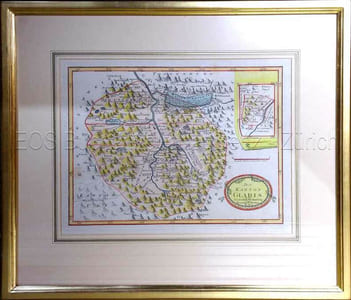
Référence : 644DGAlbrecht, Ignaz (1759-1796):
Der Kanton Glaris.Wien, ca. 1796. Kolorierte Kupferstichkarte. Plattengrösse: 24 x 31 cm.
Blumer 300. - Aus dem Werk: "Schauplatz der fünf Theile der Welt", zweiter Teil. Herausgegeben von Franz Johann Joseph von Reilly in Wien. - In Goldrahmen.
CH-8001 Zürich, Suisse
250,00 CHF
Livres
Référence : 1249ALEXANDRESCU, S., PARRET, H. en QUIK, T.( red.).
HEMEL EN AARDE. WERELDEN VAN VERBEELDING.Amsterdam, Uitgeverij John Benjamins, 1994 Geillustreerde cover, frontispice, 17x24 cm., 280 pp. en XLIX kleurenillustraties. ISBN 9027220891.
Begeleidend boek bij de gelijknamige tentoonstelling in het Bonnefantenmuseum te Maastricht ( 23 november 1991 - 23 februari 1992 ).
Antwerpen, Belgique
10,00 €
Livres
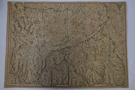
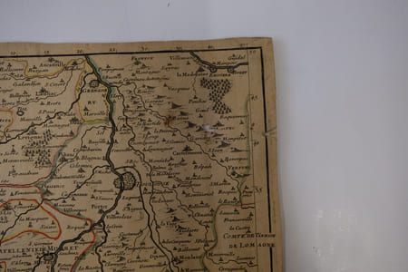
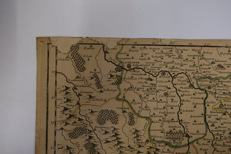
Référence : CARTE2T10Alexis-Hubert Jaillot
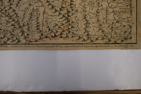
Les élections de comenge, d’Esterac, partie de celles de rivière Verdun & d’Armagnac, le Pays des quatre Vallées, le Nébouzan et le Comté de Foix1695, à Paris chez l'Auteur. 65x47cm (marges à ras). Carte réalisée par Jaillot. Épreuve originale de 1695 tirée de l'Atas François. Colorisation des limites datant de l'époque. Deux restaurations au coin gauche de la marge supérieure. Pliure verticale au milieu de la feuille. Brunissure normale. Charmant exemplaire
Alexis-Hubert Jaillot (1632-1712) est un ingénieur géographe et cartographe français, imprimeur à Paris, de la fin du XVIIe siècle et du début du XVIIIe siècle, au service du roi Louis XIV.
Bayonne, France
250,00 €
Livres
Référence : 70339Alexis-M. G
Atlas de G ographie Physique, Politique et Historique., H. Dessain, 1905 Hardcover, 140 pages, 23,0 x 32,0 cm, FR. En bon tat.
Atlas de G ographie Physique, Politique et Historique.
Antwerpen, Belgique
25,00 €
Livres
Référence : 65765Alfred Hiatt
Dislocations: Maps, Classical Tradition, and Spatial Play in the European Middle Ages, Brepols, 2020 Hardback, xii + 347 pages, Size:152 x 229 mm, Illustrations:42 col., Language: English. ISBN 9780888442185.
Summary In Europe, during the Middle Ages, classical Greek and Roman geography continued to provide the fundamental structure for knowing the world's places and peoples. From encyclopedic compendia such as the Natural History of Pliny the Elder and its redaction in Julius Solinus's Polyhistor to the works of canonical Roman poets such as Virgil, Ovid, and Lucan, the geographical content of antique texts invited study and explication. Yet medieval authors well knew that classical spatial order, itself full of lacunae, only infrequently corresponded to their own reality. Dislocations: Maps, Classical Tradition, and Spatial Play in the European Middle Ages considers the ways in which medieval and, later, humanist geography absorbed and reinvented classical spatial models in order to address key questions of historical change, migration, and emerging national, regional, and linguistic identities. Drawing on a wide range of literary texts, maps, and geographical descriptions - and utilising the ancient but now largely discarded scholarly genre of the dialogue - Dislocations argues that medieval spatial representation was complex and richly textured, whether in the form of a careful gloss in a manuscript of Lucan's Civil War, or as the exuberant sexualized allegories of the fourteenth-century papal notary Opicinus de Canistris. The book also explores a further kind of dislocation: the surprising connections between medieval geographical thought and twentieth- and twenty-first-century visual arts, including Dadaism and the remarkable Mappamundi Suite of the Gujarati artist Gulammohammed Sheikh. While past spatial orders may be relegated to obscurity, they just as often linger - in archives, memories, and ruins - to be retrieved and reanimated in revealing ways.
Antwerpen, Belgique
95,00 €
Livres
Référence : 17190[Algérie] .
Carte départementale Constantine. AlgérieE. Plon Nourrt & Cie Paris, sans date (vers 1900), couverture de percale brique, carte repliée au 1/1.450.000 gravée par E. Guillot, imprimée par Dufrénoy. La carte dépliée mesure environ 37 x 50 cm. Parfait état.
Nantes, France
20,00 €
Livres
Référence : 17189[Algérie] .
Carte départementale Oran. AlgérieE. Plon Nourrt & Cie Paris, sans date (vers 1900), couverture de percale brique, carte repliée au 1/1.550.000 gravée par E. Guillot, imprimée par Dufrénoy. La carte dépliée mesure environ 37 x 50 cm. Parfait état.
Nantes, France
20,00 €
Livres
Référence : 97651ALINHAC G.
"Historique de la cartographie (2 volumes); tome 1 : Texte; tome 2 : Planches."Paris, Eyrolles, 1973. 21 x 27, 2 volumes, tome 1 : v-109-iii-42 pages, tome 2 : 77 planches, broché, très bon état (sauf cachet d'ex-propriétaire).
"Institut Géographique National; Ecole Nationale des Sciences Géographiques."
Bruxelles, Belgique
35,00 €
Livres
Référence : 141145aafALIPRANDI, Laura et Giorgio:
Les Grandes Alpes dans la cartographie. 1482-1885. Vol. I : Histoire de la cartographie alpine.Grenoble, éd. Libris, 2005, in-4to, 359 p., richement ill., reliure toile avec jaquette illustrée sous emboîtage. Etat neuf.
1ère édition, illustrée de 433 cartes en noir et en couleurs, et de nombreuses illustrations (portraits, fac-similés) dans le texte. Cette nouvelle version de l'ouvrage de 1974 est entièrement refondue et considérablement augmentée.Ouvrage de référence sans rival sur la cartographie des Alpes, dans une élégante présentation, avec une riche iconographie.

Fribourg, Suisse
50,00 CHF
Livres
Référence : 948ALLAIN, Maurice
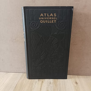
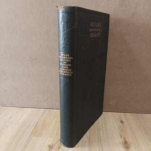
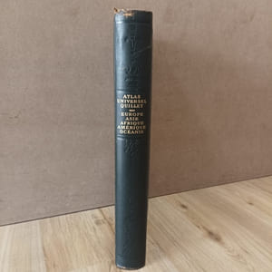
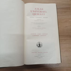
Atlas Univervel Quillet : Europe, Asie, Afrique, Amérique, Océanie1951 - reliure - Librairie Aristide Quillet - MCMLI (1951) - Grand in-folio (46 x 27 cm), plein cuir avec décors à froid sur les plats et le dos, titre doré au dos et au premier plat, reliure à spirale - 80 cartes dépliantes en couleurs, avec riche iconographie - 175 pages de tables et de textes (précis, statistiques, etc.) - Préface de Edouard Herriot - Atlas Universel Quillet : Physique - Economique - Politique, dressé par Maurice Allain, refondu, mis à jour et considérablement développé par un comité d'éminents techniciens de la cartographie moderne - Reliure mobile brevetée des établissements Prache, Auger de Franclieu
Bon état - Menus frottements sur les plats et le dos - Le mécanisme à spirale permet l'extraction aisée de chaque planche pour la consultation

Lyon, France
50,00 €